Wondering what everyday life really feels like on Rapid City’s westside and foothills? You might be picturing quiet streets, quick trail access, and a short drive to work or the hospital. In this guide, you’ll see how routines play out across 57701, from hikes and errands to commute patterns, school logistics, and the kinds of homes you can expect. You’ll also get a clear look at prices and practical tradeoffs so you can decide if this area is a fit. Let’s dive in.
Westside and foothills on the map
Locals use “westside” and “foothills” to describe the neighborhoods where the city grid meets the rising edge of the Black Hills on Rapid City’s west and southwest. Common micro-areas include The Bluffs and Carriage Hills, Chapel Valley, Copperfield along the Sheridan Lake Road corridor, and Red Rock Estates with nearby pockets.
Streets tend to be hillier than the central grid. Many homes sit on sloped lots with walkout basements and tiered landscaping. Views and privacy are common draws, whether you prefer an established subdivision or a more secluded estate setting.
If you want a balance of city convenience and foothills access, these pockets often strike that mix. You’re close to daily-use trails, parks, and major corridors, with downtown and healthcare a short drive away.
Daily rhythm: trails and parks
Outdoor time is part of the routine here. The Skyline Wilderness Area sits above the westside with multiple trailheads and loops for quick hikes, dog walks, and after-work rides. The network is used year-round, and local groups continue to improve flow sections and access. Get a feel for the area from this overview of the Skyline Wilderness Area trail network.
For an easy stroll, fishing, or a family picnic, Canyon Lake Park offers water views, a paved loop, and seasonal amenities. You can scan Canyon Lake Park details to plan a visit.
Weekend plans often expand into the Black Hills. Pactola Reservoir and Sheridan Lake are common choices for boating, paddling, or shoreline time, usually within a 20 to 40 minute drive depending on your starting point. If you ride, keep an eye on the community’s BH Flow Trail project at Skyline for updates on features and improvements.
Commute and getting around
Driving is the primary way most residents get around. Many westside and foothills pockets report about a 10 to 20 minute drive to downtown, Monument Health, and other job centers, depending on your exact address and time of day. West Boulevard and Catron Boulevard are common commute routes.
Rapid City also operates a fixed-route bus system, plus Dial-A-Ride for demand-response service. Coverage is limited compared to larger metros, so most households still rely on a car for daily errands and commuting. If you are considering public transit for part of your routine, review Rapid Transit fixed routes and Dial-A-Ride and test real timing from your address.
A typical weekday might look like this: a sunrise jog on Skyline, a 12 to 15 minute drive to the hospital or downtown, a grocery stop on the way home near the main shopping corridor, then a short evening dog walk by Canyon Lake.
Errands, groceries, and services
You will find daily needs close to home, but most larger-format shopping sits along the city’s main commercial corridors. Rushmore Mall and adjacent retail areas offer the grocery, big-box, and service options you’ll use weekly. For a quick reference to the mall area’s role in local shopping, see the Rushmore Mall overview.
Smaller neighborhood businesses and convenience stops sit closer to foothill pockets for grab-and-go errands. Specialty items or bigger home projects usually mean a short drive to the mall area or south/east corridors.
Schools and healthcare close by
Most addresses on the westside and foothills feed into Rapid City Area Schools. Examples used by many households include Pinedale Elementary, Southwest Middle School, and Stevens High. Attendance boundaries can change, so always verify your home’s assignment by address on the district site. Start with the Pinedale Elementary page for district links and contacts.
Healthcare access is a strong convenience here. Monument Health’s Rapid City Hospital and network of clinics are minutes from many westside pockets. For emergency and acute care details, see Monument Health’s Rapid City Hospital services.
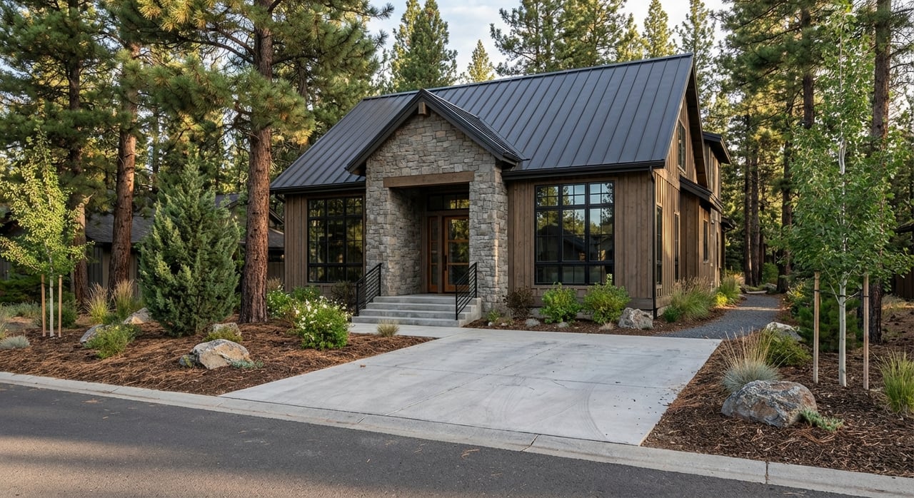
Homes and lots: what to expect
You’ll see a mix of single-family ranch and two-story homes, plus custom builds on larger or view-oriented lots. Many homes date from the 1970s through the 2000s, with newer infill and estate properties sprinkled in. Walkout basements, multi-car garages, decks, and outdoor living spaces are common because of the terrain.
Tiered landscaping and thoughtful drainage are typical features on sloped sites. If you value indoor-outdoor flow, pay attention to how main living spaces connect to decks and yards, as layouts vary widely across the area.
Price snapshot for context
Use these figures as a baseline and confirm current numbers when you start your search:
- Rapid City citywide median sale price was about $340,000 as of January 2026.
- ZIP 57701 reported a median home price around $307,500 in October 2025.
Within the westside and foothills, price tiers vary by micro-area and lot. Modest ranches on smaller lots can land near the lower end of local ranges, while custom homes with views and larger parcels often price higher, commonly from the mid $300Ks up to $800K or more based on finishes and location. Always verify current MLS data and neighborhood-level trends when you get serious.
Pros and tradeoffs
Every area has give-and-take. Here is a clear look at what many westside and foothills residents value and manage day to day.
Pros
- Daily access to Skyline Wilderness Area and Canyon Lake for quick hikes, rides, and walks.
- Views, privacy, and larger lots in many pockets.
- Quiet streets with short drives to downtown, hospitals, and shopping.
Tradeoffs
- Hillier roads and some steeper driveways, which can affect winter driving and snow removal.
- Many big-box or specialty errands require a short drive to main retail corridors.
- Transit exists, but most households will rely on a car for commuting and errands.
House-touring checklist for foothill living
Bring this short checklist to showings so you can compare homes apples to apples:
- Driveway grade and winter access. Can you navigate it safely after snow or ice without major rework?
- Lot orientation. Where does the sun hit in winter and summer, and how does that affect snowmelt, heating, and outdoor use?
- Drainage and landscaping. Look for downspout extensions, retaining walls, and grading that pulls water away from the foundation.
- Garage and gear space. Many residents store outdoor equipment, so check ceiling height and storage nooks.
- Decks and outdoor living. Confirm deck condition and how well indoor spaces connect to views and yard.
- Commute test. Time your drive to work, school, and grocery during typical hours to confirm the 10 to 20 minute pattern from your address.
- School assignment. Verify your address with the district’s current boundary resources.
Micro-area snapshots
Here is a quick, neutral overview to help you picture the westside and foothills landscape. Exact feel varies by street and lot.
- The Bluffs and Carriage Hills. Established hillside streets, homes oriented to views, and frequent walkout basements.
- Chapel Valley. Proximity to Canyon Lake and the westside park system, with a mix of home ages and styles.
- Copperfield and Sheridan Lake Road corridor. Convenient routes toward weekend Black Hills recreation and access to new construction options nearby.
- Red Rock Estates and nearby southwest pockets. Custom and estate homes on larger or view-forward lots, with a broad price spectrum.
Is the westside or foothills right for you?
If you want short drives, daily access to trails and parks, and homes designed for views and outdoor living, this part of 57701 is worth a close look. You will trade some flat-lot convenience for hillside character, and you will likely rely on a car for most errands. For many buyers, the views, privacy, and quick nature access make that tradeoff more than worthwhile.
When you are ready to explore, consider pairing neighborhood tours with timed drives, a quick Skyline hike, and a stop at Canyon Lake to picture your routine. If you want construction-savvy guidance on home condition, renovation potential, and value, reach out to Jennifer Landguth for local help.
FAQs
Are there daily-use trails near Rapid City’s westside?
- Yes. Skyline Wilderness Area offers in-city loops for short hikes, rides, and dog walks, and Canyon Lake Park adds paved paths and water views. See the Skyline trail network and Canyon Lake Park details.
Will I need a car to live in 57701’s westside and foothills?
- Most residents drive for errands and commuting. Rapid Transit runs fixed routes and Dial-A-Ride, but coverage is limited. Review transit service details before relying on it.
How close is hospital care to the westside and foothills?
- Monument Health’s Rapid City Hospital and clinics are minutes from many pockets. For emergency care information, visit Monument Health services.
What home types are common in the foothills?
- You will see single-family ranch and two-story homes, plus custom builds. Walkout basements, multi-car garages, decks, and sloped lots are common features.
What are typical commute times from the westside to downtown?
- Many addresses report about a 10 to 20 minute drive to downtown and major employers, depending on the exact location and time of day.
How do school assignments work on Rapid City’s westside?
- Most addresses feed into Rapid City Area Schools. Always verify by address using district resources. Start with the Pinedale Elementary page for links and contacts.